
Walk a Fort Worth Street by Address
A Fort Worth street search works best as a short evidence trail, not as a list of assumed occupants. Start with an exact property address in the Tarrant Appraisal District Property Search. The card supplies an account, property address, city, owner label, mailing address, legal description, subdivision, and instrument lead. Those fields make it possible to keep each parcel distinct when a long street has similar numbers or repeated surnames. The assessed owner is useful evidence of ownership, but it does not establish who currently occupies the property.
- Enter the address in TAD and preserve the account, situs address, owner label, legal description, subdivision, and instrument.
- Find the parcel in the county map viewer, then compare nearby street addresses and the parcel outline before treating a result as the same location.
- Use the instrument or owner name in the County Clerk index to locate the recorded transfer and its grantor and grantee.
- Use the voter lookup only to confirm a known registration or assign a known address to a precinct and districts. It is not a street-by-street household census.
- For an older address, consult a reverse or criss-cross volume and then test the household against a directory image, census, or newspaper notice.
That address-to-owner-to-deed-to-voter-to-criss-cross sequence gives a Fort Worth street directory a clear stopping point. It separates current parcel data from historical household evidence.
Fort Worth Street Directory Record Layers
Each address-keyed source has a narrow job. County property data connects a street number to a parcel. City tools attach events or services to an address. Recorded instruments establish a transfer trail. Historical directories can place a household or business at a number for a particular year. The following Fort Worth street directory matrix identifies the record, its keeper, and its limit.
| Address record | Fort Worth keeper | Useful street detail | Access route |
|---|---|---|---|
| Appraisal parcel card | Tarrant Appraisal District | Account, situs, city, owner label, mailing address, legal description, value, instrument | Free property search |
| Parcel map | Tarrant County GIS | Parcel geometry, address, owner, ZIP, subdivision, deed and value fields | Public Map Viewer |
| Recorded real-property instrument | Tarrant County Clerk | Grantor, grantee, subdivision, document type, document number, date and OCR scope | Official Records Search |
| City address layers | City of Fort Worth | Permits, code cases, generalized crime, flood, neighborhood and service context | OneAddress |
| Reverse directory and census | Library and archive collections | Historical occupants, businesses, street context and household clues | Repository scan or reading room |
The parcel account and legal description are better bridges than a road name alone. A street can cross jurisdictions, a mailing label can differ from the city field, and one address can change after a replat.
When an online record does not answer the question, preserve the account or instrument and use the documented fallback. County Clerk historic images are still being converted, and Central Library assistance is available at 817-884-1069 for a missing historic image. The Fort Worth History Center and Tarrant County Archives add directory scans, ledgers, maps, newspapers, and catalog guidance. A Texas Public Information Act request should identify an existing record, department, address or case number, and date range rather than ask for a new household compilation.
Search Fort Worth Streets in TAD
The TAD homepage offers a free-text field and separate Residential, Commercial, Mineral, and Personal Property selectors. Results can show Account #, Geo Reference, Property Address, Property City, Primary Owner Name, and Market Value. An expanded card adds the owner mailing address, legal description, subdivision, neighborhood code, instrument, document links, and map links. Use a house number and street, then inspect the Property City rather than treating a postal label as a jurisdiction.
| TAD control or field | How it helps a street search |
|---|---|
| Property-type selector | Choose Residential, Commercial, Mineral, or Personal Property before the free-text search. |
| Enter Your Search | Tests the exact address or a street term in TAD’s public search. |
| Account # and Geo Reference | Preserve these identifiers before moving to GIS or a deed search. |
| Property Address and Property City | Identifies the situs location and the city field shown by the appraisal record. |
| Primary Owner Name and Market Value | Shows the assessment owner label and a valuation field, neither of which proves residency. |
| Export and page size | Result controls observed at 25, 50, and 100 entries help review a broad street result. |
A captured TAD property result shows why the distinction matters.
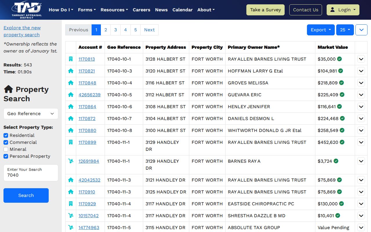
The result layout places property, owner, mailing, legal-description, instrument, and map clues together. Treat a mailing address as a correspondence field, not a statement that the owner lives at the parcel.
Fort Worth Parcels Along One Street
The Tarrant County Public Map Viewer accepts Address, Account, and Owner searches. Its parcel layer exposes a situs address, owner and mailing address, ZIP, legal-description fragments, subdivision, school, deed date, deed book and page, values, year built, and instrument number. Use an address search, zoom to the parcel, turn on the property layer, and compare geometry before moving to the next number on the road.
County GIS is especially useful where an address is near a city line or where several parcels share a name. The map viewer also offers layer controls, facilities, FEMA information, voter lookup, and a crime-map link. Its parcel record is geographic and assessment-based, so it remains a map and property tool, not a roster of every person at an address.
Keep a small address log while moving along a road: target address, account, parcel geometry, legal description, subdivision, owner label, mailing address, instrument, and capture date. If a parcel has no situs address, shared ownership, a condominium configuration, or a road right-of-way between lots, record that condition instead of forcing an address-to-person conclusion. The same disciplined notes make a later deed or historic-directory check reproducible.
The public map viewer displays the address, account, and owner controls used for this address-by-address work.
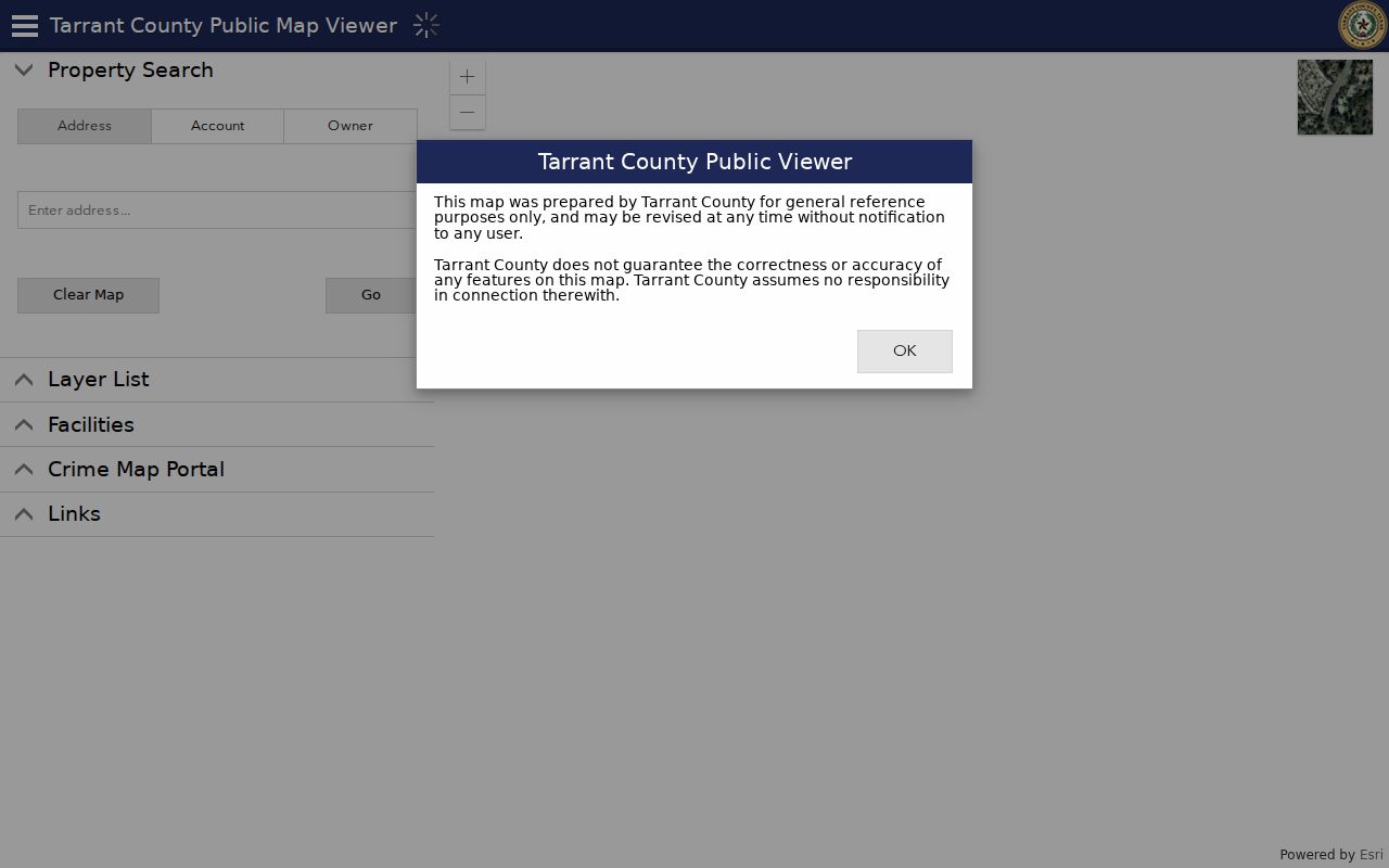
Layer controls make it possible to compare parcel lines and surrounding addresses before copying a legal description into a recorder search.
Fort Worth Street Deed Trails
The Tarrant County Official Records Search is the recorder route for a parcel’s recorded instruments. Its Quick Search and Advanced Search tabs use a Real Property department. The Search Term field accepts a grantor, grantee, subdivision, document type, or document number. Optional from and to dates work with Recorded Date shortcuts ranging from the last 24 hours through the last year. Search Index Only searches indexed data, while Search Index & Full Text (OCR) searches document contents and handles multiple words as a phrase.
Follow a recorded transfer backward by locating the current owner’s purchase, noting the seller, and then locating the seller’s earlier acquisition. Save the recording date, instrument number, document type, exact indexed names, and legal description at every link. The accessible official page does not state an earliest online year. Historic images continue to be converted, and the Clerk directs researchers to call Central Library at 817-884-1069 when an image cannot be found. Unofficial copies may be free; certified and office copies follow separate charges.
The official deed-index screen illustrates the term, date, and index-versus-OCR choices.
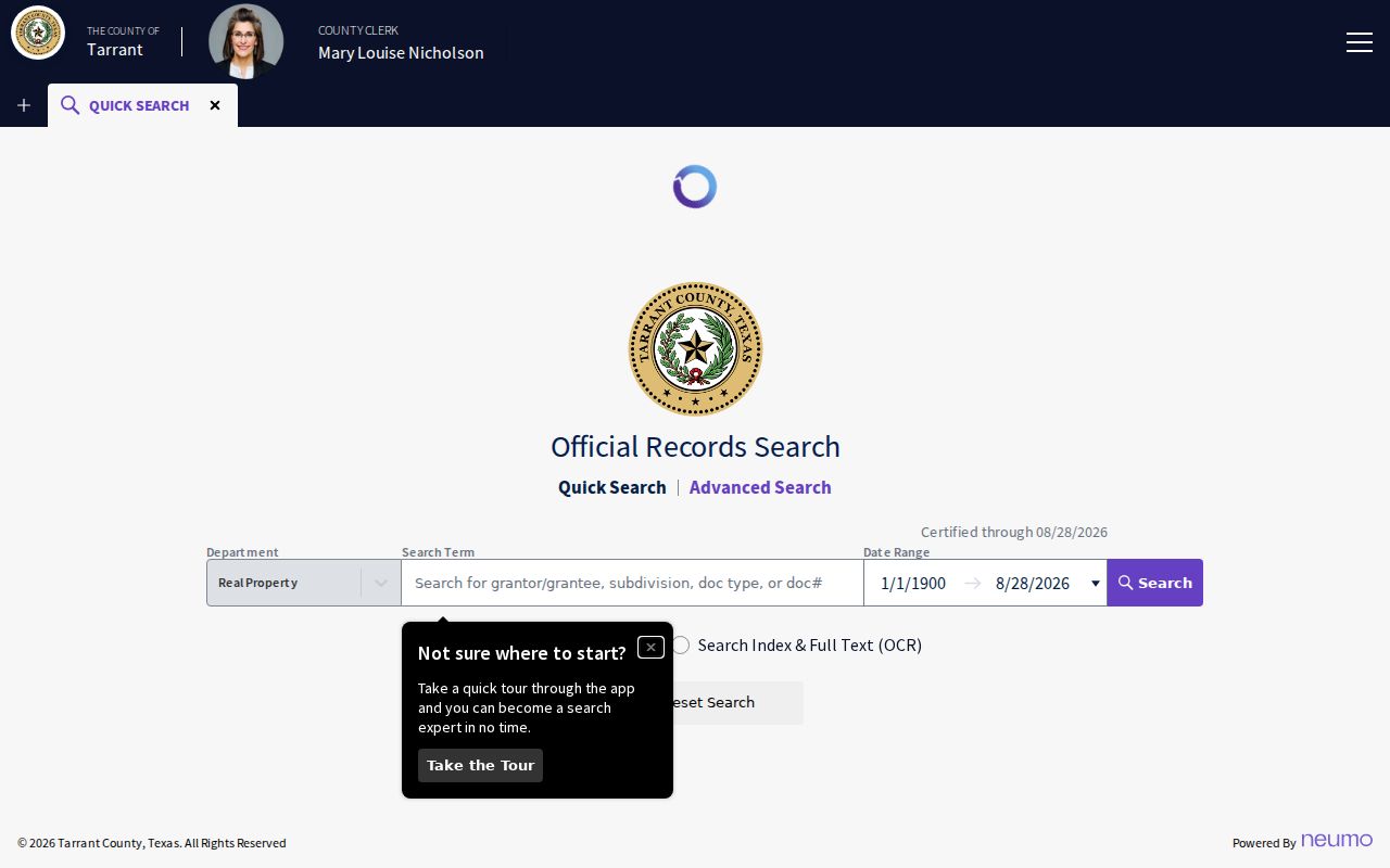
These controls support a focused instrument search after the parcel card supplies a name, subdivision, or document number.
Fort Worth Address Permits and Code
Fort Worth OneAddress is an address-first city tool. It brings together location data, permits, code violations, generalized crime, flood, neighborhood information, and city services. The crime layer is generalized to the hundred block and juvenile information is removed. That makes OneAddress useful for describing public city context, while also showing why it cannot establish a household list or an exact personal pattern.
The City’s issued-permits page supplies maps, a specific permit table, a full data download, certificate-of-occupancy material, and an Accela status login. Permit details can document work history at a location, but a permit holder or applicant does not by itself prove ownership or occupancy.
The City’s issued-permits display provides the map, table, and download channels.
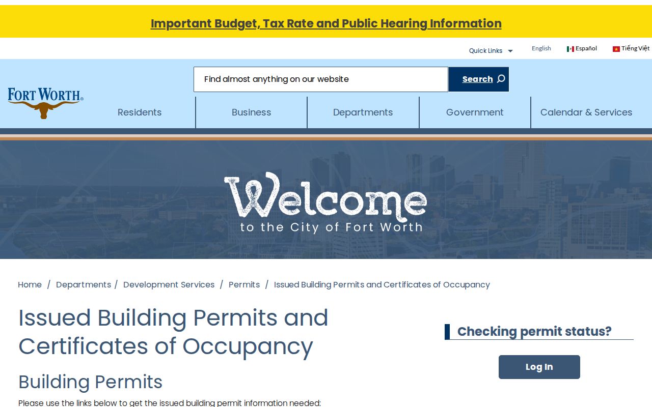
Use a permit as a dated address event, then confirm ownership through the parcel and recorded-instrument trail.
Fort Worth Street Numbers and Mail
Fort Worth’s street-numbering rule creates a useful search quirk. The city’s annexation materials say the fire-code addressing grid radiates from the Tarrant County Courthouse. The Fire Department controls street naming and numbering for safety, while USPS controls the city and ZIP designation. A mailing-city label is therefore not a substitute for the city field, parcel boundary, or legal description.
When an address has changed, USPS may use old and new labels for as long as 18 months. Search both forms in TAD, permits, plats, directories, and newspapers. A parcel that was annexed into Fort Worth can also keep a county, school, drainage, or postal label that does not match its current city name.
Note: Preserve the spelling, street suffix, and number exactly as each source prints them before deciding that two address results conflict.
Fort Worth Voter Records Are Narrow
The Tarrant County Voter Lookup returns a registration record with name, address, status, VUIDs, precinct, districts, and an election-history control. It can confirm a known registration or place a known address within election geography. It does not provide a button to enumerate every voter, much less every resident, on a Fort Worth street.
Texas Election Code privacy and use rules protect certain voter data and addresses. A separate public-information request may be available for an existing elections record, but it can involve fields, costs, protected addresses, and use restrictions. The street directory should stop at the known-record and public-geography layer rather than turn an address into a compiled resident census.
Fort Worth Street Directory Terms
Address research uses terms that look alike but refer to different evidence. Keeping the labels straight prevents a mailing field or an old directory entry from being mistaken for current ownership.
- Parcel
- A mapped piece of land or property unit tied to an account and parcel geometry.
- Situs address
- The physical location of the parcel. It can differ from the owner’s mailing address.
- Plat
- A recorded map that identifies lots, blocks, easements, rights-of-way, or subdivision layout.
- Criss-cross directory
- A reverse directory arranged by street and house number rather than only by a person’s name.
The 1907–08 reverse directory is available as a digitized Fort Worth street-directory page. Inspect its scan rather than relying only on OCR, which can misread a name or number.
Limits of a Fort Worth Street Directory
Property, map, deed, permit, and directory records have distinct limits. A parcel owner is not automatically the resident. A deed records a transfer, not each period of occupancy between recordings. A historical directory may show a business, church, cemetery, vacant space, or a “rear” entry instead of a household. Utility customer records, motor-vehicle addresses, and a full count of people who sleep at an address are not ordinary public street records.
Lawful personal use. Use Fort Worth address records for family history, estate research, civic transparency, or property questions. Do not use them to stalk, harass, intimidate, or harm anyone.
For a historical household rather than a current parcel question, the collection details and coverage gaps are described in the Fort Worth city directory collections.