
Fort Worth Neighbors by Block
Start with a known Fort Worth address and choose the source that answers the narrow question at hand. The parcel layer identifies geometry and public assessment fields. TAD supplies a record card for an assessed parcel. OneAddress adds city address context. Historic reverse directories can show an earlier block, while the voter tool assigns a known address to an election geography. Those layers are not interchangeable, and no one of them is a census of everyone who lives nearby.
| Source | Block results | Access |
|---|---|---|
| Tarrant County Public Map Viewer | Adjacent parcel polygons, situs, account, owner and mailing fields, legal-description and value attributes | Free search by Address, Account, or Owner, then identify nearby features |
| Tarrant Appraisal District | Assessed parcel card, owner label, mailing address, subdivision, instrument, value, and documents | Free text search and GIS links |
| Fort Worth OneAddress | Address-keyed permits, code, generalized crime, flood, neighborhood, facilities, and services | One address at a time; juvenile material is removed and crime is generalized |
| Reverse directories and census | Historic street occupants, businesses, and building or household context | Library, archives, UNT/LOC scans, and federal images; years have gaps |
| Tarrant County Voter Lookup | Known-address precinct and district context | Free lookup, subject to protected fields and voter-list rules |
| City neighborhood registry | Active registered organization category, boundary or contact route where provided | Voluntary registration with annual updates |
The map may show an owner name and mailing address for a parcel. It does not establish that the assessed owner is an occupant or that every occupant has been identified. A common surname on two adjacent parcels also needs a separate time, address, or record identifier before it is treated as an identity match.
Fort Worth Neighbor Geography
Use “neighbor” as a geographic description, not as a claim that two people know one another. For an immediate block, distinguish parcels that share a boundary from lots across a street, alley, or road right-of-way. A corner parcel can have more than two sides. A multifamily parcel may represent one parcel with many occupants, and a common owner or trust can appear across several lots. Some polygons have no situs address at all.
When a boundary matters, the parcel map is a lead and the survey or subdivision plat controls its legal interpretation. The public map identifies north, south, east, and west candidates by position. The Tarrant County Clerk's Official Records Search can then be used to examine an instrument and legal description for the selected parcel. A business, church, or entity may use a site without appearing as its assessed owner.
- Parcel
- A mapped land unit with an account and assessment attributes. It is not a complete list of people connected to the site.
- Situs address
- The physical location used for a parcel. It may differ from the owner mailing address.
- Right-of-way
- Land used for a street, alley, or similar public passage. It can interrupt legal adjacency between parcels.
Fort Worth Neighbor Parcel Fields
The Tarrant parcel ArcGIS layer uses SITUS_ADDR as its display field. It exposes the bridge between a map polygon and a record search: ACCOUNT, OWNER_NAME, OWNER_ADDR, LEGAL_1 through LEGAL_4, SUBDIVISION, CITY, ZIPCODE, and deed or instrument fields. Preserve the field label with the value because a mailing field means something different from a situs field.
The ArcGIS service metadata shows the Fort Worth neighbors parcel fields used to identify an adjacent record without guessing at its meaning.
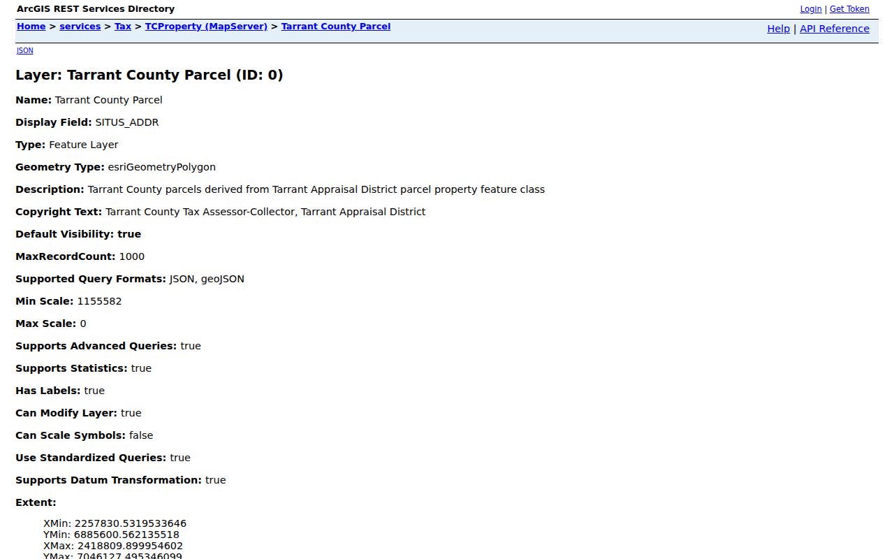
Those fields support a repeatable map-to-record trail, while the document image and its recording date remain the better source for a transfer.
TAD adds assessment values, exemption or status flags, map links, and document links. Assessment values are not transfer consideration, and an exemption or system flag is not a conclusion about an occupant. Keep an account number exact because it is the best way to return to the same parcel later.
Mapping a Fort Worth Neighbor Block
The immediate-block method begins with the target polygon, not with a broad name search. It remains small enough to reproduce and makes the distinction between legal adjacency and an across-the-street location visible. A simple record trail is target address to parcel layer to adjacent polygons to account and situs to TAD or Official Records. Keep a capture date because map and assessment values change.
- Search the target address in the Tarrant County Public Map Viewer and select the property or parcel layer.
- Identify every polygon that shares a boundary, then separately label parcels across a street or alley.
- Record the direction, account, situs address, legal description, owner label, mailing address, and displayed instrument for each selected parcel.
- Open the corresponding TAD card and Official Records result only to confirm the parcel or instrument trail.
- Mark a condominium, common parcel, road right-of-way, or missing situs address instead of forcing a person-name result.
For the broader chain along an entire named road, the Fort Worth street directory has the address-by-address workflow. The block method stops with the immediate parcel context and public organization routes.
Fort Worth Neighbor Registry Routes
Fort Worth Community Support maintains a registry for neighborhood, community, and faith-based organizations. Registration is voluntary and the City asks groups to update their information annually. The available categories include voluntary and mandatory HOA records, multifamily organizations, neighborhood alliances, community groups, faith-based organizations, and redevelopment groups. The GIS layer represents active registered groups in the city and ETJ, not every local association.
The City Community Support page identifies the categories and registration route for Fort Worth neighbors who need public organization context.
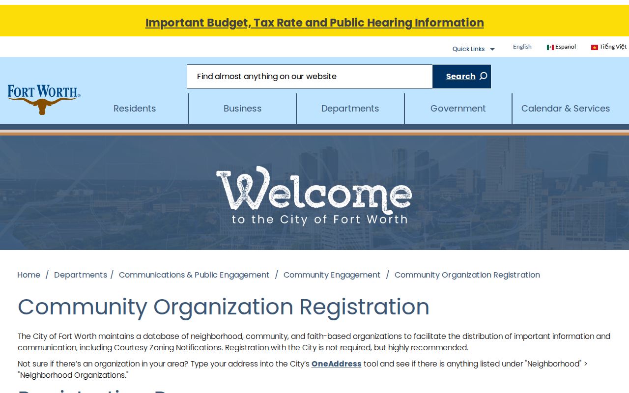
A category can identify a route for confirmation, but it does not establish membership or speak for a particular household.
| Organization category | Appropriate public use |
|---|---|
| Voluntary neighborhood organization | Use the City registration or Community Engagement route to confirm whether an active record exists. |
| Mandatory HOA or multifamily organization | Registration category only. Do not infer a roster, fees, or a specific resident relationship. |
| Alliance, community, faith-based, or redevelopment group | Look for the organization's public contact route and active registration information, not private member details. |
Fort Worth Neighbor Organization Status
City planning material names umbrella areas such as North Fort Worth, Riverside, Ridglea Area, Westside, West 7th, and Neighborhoods of East Fort Worth. These are coverage or coordination labels, not membership lists. The old Oakhurst Alliance of Neighbors sample shows the kind of fields that may appear, including organization name, boundary or address, voluntary status, contact person, meeting information, council district, and police division. Its current values need confirmation.
The City neighborhood database replacement notice directs Fort Worth neighbors to Community Engagement for current organization confirmation.
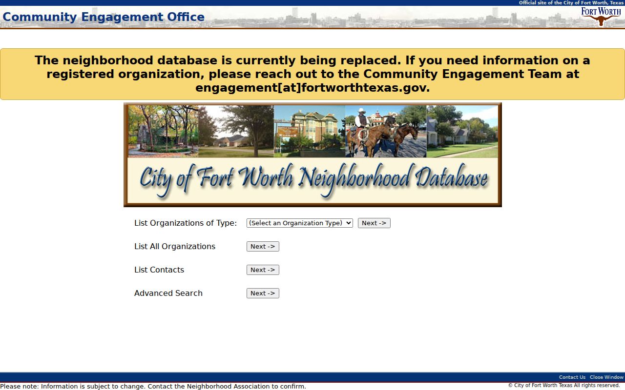
That replacement route is more reliable than treating an older sample record as evidence that a group remains active.
No complete public member directory, block-watch roster, or congregation roster was located in the official sources. An absent registry entry does not prove that a neighborhood group does not exist, and a public organization contact is not a source for private household names.
Fort Worth Neighbor Voter Context
The Tarrant County Voter Lookup can assign a known address to a precinct and districts. Its name search accepts last name, first name, date of birth in mm/dd/yyyy, or State Voter ID, and its result can show a name, address, status, voter IDs, precinct, and district assignments. Address, ZIP, and location modes offer geography confirmation. “View your election history” concerns elections displayed by the tool, not ballot choices.
It is not a street census. The lookup does not offer a public button that enumerates every nearby registered voter, every household member, or every person at a parcel. A separate voter-file request may be available under Texas Election Code §§18.008 through .010, subject to fields, reproduction costs, protected addresses, and permitted-use rules. Do not infer party from an election-history entry because the inspected lookup does not show a party-registration field.
Fort Worth Neighbors Source Comparison
Official and commercial categories serve different purposes. A public parcel layer identifies attributes held by a government data service and lets another researcher repeat the address and account search. Commercial neighbor tools may combine public and brokered information, but their coverage, update dates, correction practices, and source provenance vary. Treat any commercial-category result as an unverified lead rather than a substitute for the parcel, clerk, or city source.
| Source category | Useful block question | Limit |
|---|---|---|
| Official map and appraisal records | Which parcels adjoin the target and what public assessment attributes are displayed? | Owner or mailing fields do not prove every occupant. |
| Official city and registry records | What public address service or registered organization route applies? | Registration is voluntary and not a membership list. |
| Commercial neighbor category | Can an independently verified lead suggest a custodian or date to check? | Coverage and accuracy vary; do not treat it as an official record. |
Fort Worth Neighbor Privacy Limits
Stop at the parcel and public-organization layer when a result would require a private household list, utility account, delivery record, or motor-vehicle address. Stop and redact when a map or filing appears to reveal an Address Confidentiality Program location, a protected official address, or a sensitive identifier. Texas Election Code §13.004 also restricts specified voter information and protected residential-address categories.
For a historical block, use the same directory year, census enumeration district, Sanborn sheet, plat, and newspaper context. A 1907 directory can show a church, cemetery, business, vacant lot, or “rear” entry where a modern map shows a parcel. When a directory year is missing, use the next available year and label the gap rather than making a household inference.
Lawful use. Fort Worth neighbor research is limited to lawful geographic and community context. Do not use public records to stalk, harass, intimidate, or harm anyone; Texas Penal Code §§42.07 and 42.072 address harassment and stalking.